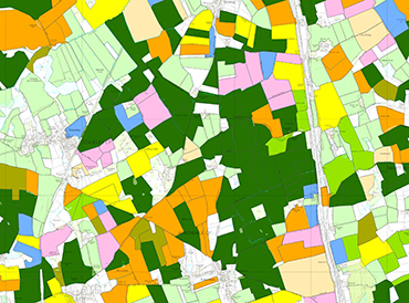
We use a combination of satellite images and digital cartography to derive land cover information for the UK. Land cover is based on UK Biodiversity Action Plan Broad Habitats classes. It is used by government departments and agencies, county councils, charities and commissions, as well as water companies, environmental management bodies, consultancies and researchers. It has wide application in many sectors and is available in different formats to suit the requirements of users.
Product: UKCEH Land Cover Maps

UKCEH’s Land Cover Maps are a trusted source of information on land cover for the whole of the UK and have been used for the management of natural resources, urban planning, carbon accounting and flood risk modelling, to name but a few. UKCEH’s Land Cover Maps have been successfully used in a wide range of applications by government departments and agencies, county councils, charities and utility companies.
Product: Land Cover® plus: Crops
UKCEH Land Cover® plus: Crops, produced each year since 2015 in collaboration with Remote Sensing Applications Consultants Ltd., uses satellite-based data to provide a highly accurate picture of cropping patterns – both the type of crop planted and how much land it occupies – for each of the two million agricultural fields in Great Britain.
Product: UKCEH Land Cover® plus: Fertilisers and Pesticides
UKCEH Land Cover® plus: Fertilisers and Pesticides, the latest addition to the land cover map series, combines crop data with county-level information from official government surveys of average rates of pesticide and fertiliser use per hectare for each crop, to estimate national patterns of average annual chemical application, at 1km resolution.