Measuring and enhancing ecosystem services and natural capital
Assessing our ecosystem services and natural capital allows us to capture the importance of nature’s assets and the benefits that flow from them. This gives the natural environment a place in decision-making and allows more sustainable management choices for the future. Our scientists are assessing the extent, quality, trends and vulnerability of the UK’s natural capital. Our research into natural capital indicators supports the 25 Year Environment Plan.
UKCEH develops natural capital and ecosystem services modelling tools, which allow us to calculate the impacts of land use change and land management on ecosystem services provided in rural and urban locations. These tools are used to identify locations where land management change should achieve maximum benefit. They have been applied to issues as diverse as Brexit planning, tree planting for net zero carbon, and planning urban and transport green infrastructure.
Tool: ASSET
The ASSET tool explores the impacts of potential changes in the way we manage the UK countryside on society and the environment. ASSET enables exploration of the likely location and impacts of policies and practices, including afforestation, habitat restoration, land sharing/sparing and agricultural intensification, on livelihoods, biodiversity and a wide range of ecosystem services. Visit eip.ceh.ac.uk/asset/
Tool: E-Planner
The E-Planner tool has been developed to help farmers and other land mangers identify the most suitable places for different environmental management options. The tool uses detailed environmental datasets to produce maps of the relative suitability of land for different environmental outcomes. This currently includes water resource protection, woodland creation, sown winter bird food, flower-rich pollinator habitats and wet grassland restoration. Visit assist-e-planner.ceh.ac.uk/About
Case study: Evaluating Wales’ natural resources

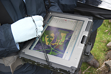
UKCEH led the Welsh Government GLASTIR Monitoring and Evaluation Programme (GMEP) between 2012 and 2016. The GMEP programme collected evidence through a field survey of 300 1km squares across Wales, for the Glastir priorities (carbon, water, biodiversity, access and historic features). The monitoring and analysis of the whole ecosystem, incorporating environmental, social and economic analysis, allowed for a robust analysis of trade-offs and co-benefits of different landscape management options.