Professor Laurence Jones, Wetlands Grasslands and Croplands Science Group Leader at UKCEH highlights some of the recent work of the urban team to inform planning of urban blue and green spaces to promote a better urban future on Urban October.
As cities continue to grow, so do the challenges they face. From rising temperatures and increased flooding to air pollution and noise, urban environments are under increasing pressure. These problems affect not only our health but also our environment and economy. But what if the solutions lie in the very spaces we live in?
At UKCEH, we are working towards creating smarter, greener cities. As part of UN-Habitat's Urban October initiative, I’m excited to share how we're helping to reimagine urban spaces, making them healthier, more sustainable, and more liveable for all.
Green and blue spaces—parks, trees, rivers, lakes—are vital to the fabric of city life. They cool our streets during heatwaves, reduce air pollution, and provide much-needed peace and quiet in a world full of noise. More than just pretty landscapes, these spaces have real, measurable benefits for both people and the environment.
City planners are now being urged to integrate more of these green and blue spaces into urban designs. In the UK, for example, the Green Infrastructure Framework aims to increase urban green cover to 40% in residential areas. To help planners achieve these goals, we are creating new tools and models to help understand what the benefits are, make a case for investment in green and blue spaces, and find the best places to create or enhance these in our cities.
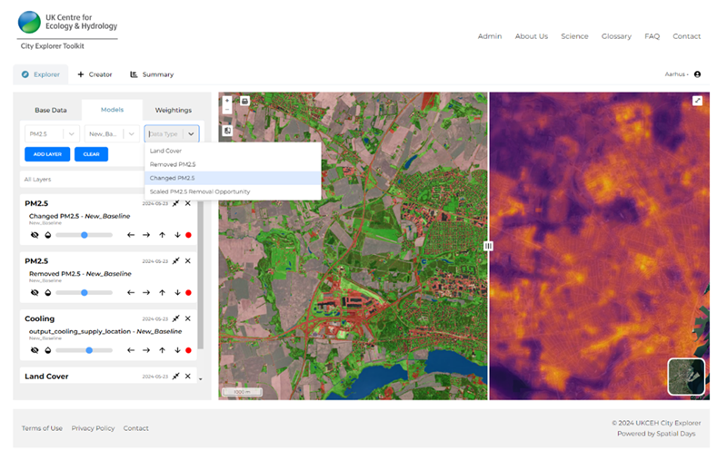
One of our key developments is the City Explorer Toolkit, an interactive web-based tool designed to support urban planners.

This tool makes it easier for local authorities to identify where new green and blue spaces will have the most impact—whether it’s cooling down neighbourhoods during a heatwave or improving air quality in areas that need it most. It brings together a suite of models and spatial data to calculate how these spaces can tackle challenges like flooding and pollution, and uses population and social data to make sure the benefits reach the communities that need them the most.
We have toolkits running for Portsmouth in the UK, and Aarhus in Denmark, and have applied the models in cities across the globe, helping planners make informed decisions that promote a more sustainable future. If your city is interested in using the City Explorer Toolkit, we’d love to hear from you! Contact us at cities@ceh.ac.uk
Together, we can create urban environments where both people and nature can thrive.