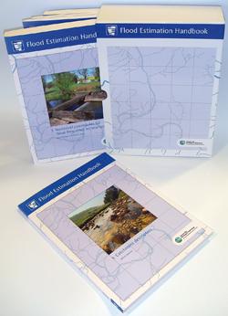
The Flood Estimation Handbook (FEH) and its related software offer guidance on rainfall and river flood frequency estimation and development site runoff rates across the UK.
These are required for:
- Flood risk assessment
- Flood defence planning
- Design of structures such as bridges, culverts and reservoir spillways
- To form the basis of flood risk maps
- Rarity assessment of notable rainfalls or floods
- SuDS and traditional drainage system design
The procedures are clearly explained and supporting theory and results are included.
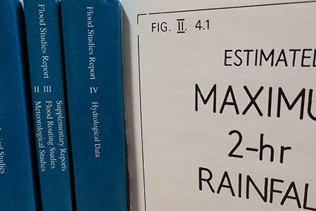
The FEH largely replaced the Flood Studies Report (1975).
Inside the Flood Estimation Handbook

The Flood Estimation Handbook is a set of five printed volumes (Centre for Ecology & Hydrology, 1999, ISBN: 9781906698003). Downloadable pdf files are available for free using the links below.
Volume 1: Overview
Volume 1 contains an overview of the procedures, a summary of how the methods differ from earlier guidance and an introduction to the data and software accompanying the Handbook. It includes important guidance on the choice of method to address a specific flood estimation problem. Later chapters are either topic-oriented or essentially informative. The last section presents a UK-oriented bibliography of technical guidance in the many environmental planning and engineering issues that impinge on flood defence.
Volume 2: Rainfall frequency estimation
Volume 2 has been largely superseded by the FEH13 rainfall model, based on the outputs of the project Reservoir Safety: Long Return Period Rainfall. Rainfall estimates from both the FEH13 model and the FEH99 model described in Volume 2 are provided on the FEH Web Service.
Volume 2 presented the methods for estimating rainfall frequency in the UK, using a model relating rainfall depth, duration and frequency. The Volume 2 procedure is built on the Focused Rainfall Growth Extension (FORGEX) method, which generates estimates for long return periods through giving precedence to local observations and accounting for inter-site dependence in rainfall extremes.
Volume 2 also gives guidance on applying an areal reduction factor and choosing a design storm profile: both are required when deriving flood estimates by using the ReFH 2 rainfall-runoff method.
Volume 3: Statistical procedures for flood frequency estimation
Volume 3 has been superseded by the latest version of the FEH statistical method, implemented through WINFAP 5, including scientific advances developed by Kjeldsen et al (2008, 2014).
Volume 3 presented statistical procedures for using observed flood data to address questions such as “How rare was that flood?” or “How big is the expected 100-year flood?”, through flood frequency curves that relate flood size and flood rarity. Where at-site data alone are insufficient to create a flood frequency curve, methods are presented for selecting appropriate gauged sites for pooling data. Adjustments for urbanised catchments are also described.
Volume 4: Rainfall-runoff method
Volume 4 has been largely superseded by the development of ReFH and its associated publication, the FEH Supplementary Report. Volume 4 of FEH presented a comprehensive re-statement of the Flood Studies Report rainfall-runoff method including a set of updated equations to allow the method to be used with digital catchment descriptors.
Volume 5: Catchment Descriptors
Volume 5 presents a detailed description of the development and derivation of the catchment descriptors included within the FEH Web Service. Also included is an appendix listing values for 20 descriptors at the 943 gauged catchments used in the development of the methods developed in Volume 3 and Volume 4.
Related software: FEH Web Service, WINFAP 5 and ReFH 2
Our flooding software products give users the power to apply the industry standard Flood Estimation Handbook methods in a quick, effective and objective way.
FEH Web Service
The FEH Web Service provides the data and rainfall model outputs that are required to apply the UK flood frequency and rainfall estimation procedures. FEH methods are recommended methods for estimating runoff rates and volumes within the new CIRIA SuDS guidance.
WINFAP 5
WINFAP enables you to estimate peak flows and flood frequency curves for gauged and ungauged catchments, using the latest FEH methods. This flexible package provides a range of statistical analyses, based primarily on annual maximum (AM) data, but also applications of peaks-over-threshold (POT) data. The latest version, WINFAP 5, developed by Wallingford HydroSolutions*, offers additional functionality and significant improvements, including scientific advances developed by Kjeldsen et al (2008, 2014). Data for use in WINFAP is provided by the National River Flow Archive.
ReFH 2
ReFH enables you to estimate design flood hydrographs for rural and urbanised ungauged catchments across the UK. The revitalisation of the FSR/FEH rainfall-runoff method project (2001-2005), funded through the Joint Defra/Environment Agency Flood and Coastal Erosion Risk Management R&D Programme, produced the ReFH software package and a supplementary report to the Flood Estimation Handbook. The latest version, ReFH 2, incorporates scientific advances developed by Kjeldsen et al (2013) focused on improving urban and rural modelling and is available from Wallingford HydroSolutions*.
Inside the Flood Studies Report

Most of the methods detailed in the Flood Studies Report were superseded by the FEH, and any parts that are still current guidance were re-published in the FEH and its reports and guidance.
The ground-breaking Flood Studies Report was produced by our predecessor organisation the Institute of Hydrology and required the collection of data from more than 550 gauging stations. It is divided into five volumes:
- Volume I: Hydrological Studies, plus Volume I Corrigenda pages 1 and 2 (1981)
- Volume II: Meteorological Studies
- Volume III: Flood Routing Studies
- Volume IIIa: Supplementary Reports. These are additional papers relating to the Flood Studies Report, 1983-1993
- Volume IIIb: Papers of Interest (1983 list)
- Volume IV: Hydrological data. Instantaneous flood peaks for over 550 gauging stations were published in this volume along with tabulated catchment characteristics and flood statistics.
- Volume V: Maps. Twenty-four maps illustrating Volumes I and II.
Downloadable PDFs can be accessed at the bottom of this page. Please note however that Volume V: Maps cannot be downloaded as one complete volume. Instead, each of the 24 maps is available separately.