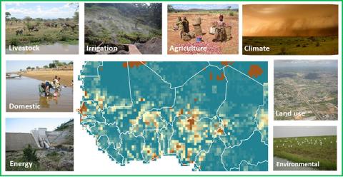
UKCEH's GWAVA (Global Water Availability Assessment) model provides integrated analysis of water sources and demands at national to continental scales.
GWAVA combines locally sourced data with global databases to give projections of future changes to water availability. These can be used to model consequential impacts, including changes to water quality and damage to river ecosystems. GWAVA is highly adaptable to low data environments and has been successfully applied both globally and at continental and basin scales across Europe, Africa and Asia for more than 20 years.

The GWAVA methodology
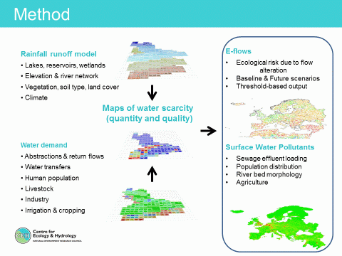
GWAVA uses a sequence of processes to represent interactions between environmental and human water systems
- Surface water and subsurface flow are represented using a gridded Probability Distribution Model (Moore, 1985).
- Natural features such as lakes, wetlands and glaciers, as well as human interventions such as reservoirs and long-distance transfers are represented.
- Water demands from household supply, irrigation, livestock and industry are modelled.
- Future changes caused by population growth, climate change, urbanisation and per-capita use of water can be represented easily.
- Optional outputs include water quality assessment (Dumont et al, 2012) and environmental flow assessment via the ERFA method (Laize et al, 2014).
GWAVA can be applied at spatial scales from 0.1° to 0.5° (about 10 to 50km) grid cells, using a monthly or daily time step. Click here to read case studies about the use of GWAVA in past projects.

