National capability for global challenges
Addressing the impacts of oil palm expansion in Liberia
Land impacts on Mesoscale Convective Systems
Nowcasting with Artificial Intelligence for African Rainfall
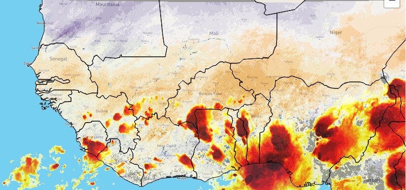
Discover more about our current and past research in West Africa with regional and international collaborators. Our science benefits from excellent in-country partnerships and together we are committed to increasing the capacity for outstanding scientific research within African research groups.
Sankore is a strategic initiative aimed at strengthening Science, Technology, and Innovation (ST&I) ecosystems in Ghana and Nigeria. It is funded by the Foreign Commonwealth & Development Office (FCDO) and being executed by UNESCO in partnership with UKCEH. UKCEH, through its West Africa Office, is leading in innovation, commercialization talks, and actions plans, with the Council for Scientific and Industrial Research (CSIR) of Ghana, and the National Space Research and Development Agency (NASRDA) and National Office for Technology Acquisition and Promotion (NOTAP) of Nigeria. UKCEH will also oversee the development of a robust ST&I Helpdesk to support FCDO and West African government partners with the demand-led ST&I technical guidance.
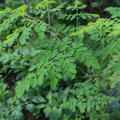
This international programme aims to deepen our understanding of the land-water-air system, its complex interactions that affect countries’ transition to net zero plus, and how we can build resilience to climate change. It will provide new knowledge and evidence, data and tools to assist countries, organisations and companies develop and deliver plans to reduce emissions, increase carbon sinks of natural and managed ecosystems, and adapt and build resilience to climate change, while considering possible cascading effects and trade-offs.
The research extends from global to regional scales, including projects of particular relevance to West Africa:
About a quarter of the world's climatically suitable areas for growing oil palm are in West and Central Africa. By 2050, it is expected that edible oil consumption in Africa will triple compared to 2013. However, whether new oil palm plantations to fulfil this demand will mainly replace forests or other crops on previously cleared lands remains poorly understood. Consequently, scientific evidence on the impact of this land conversion is currently lacking.
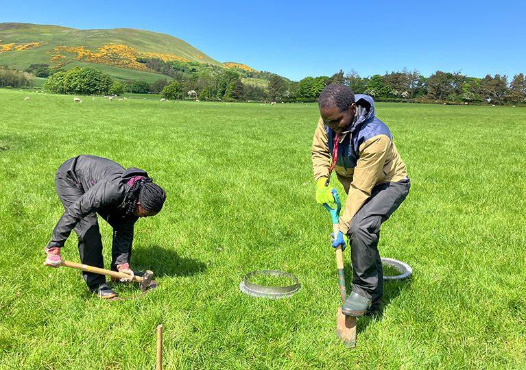 We are working with collaborators at the University of Liberia to measure greenhouse gas fluxes across different land uses in Liberia, including rainforest, smallholder farms with wild-growing oil palm, and large-scale oil palm plantations. There are currently no measured greenhouse gas data from Liberia so this project will set a baseline for future work to mitigate greenhouse gas emissions, providing the scientific evidence needed for land-use and policy decisions.
Understanding how different land management practices affect biodiversity, biogeochemistry (including changes in greenhouse gases), and crop yield will provide an approach to maximise farmers' income while also helping the environment.
Contact: Dr Julia Drewer
Mesoscale Convective Systems (MCS) form when thunderstorms join together into a huge single complex hundreds of kilometres wide causing extreme rainfall along their path. This type of storm is particularly important over West Africa, and produces the majority of rainfall here. With climate change, these storms are projected to get stronger and more frequent, leading to more flooding and damage, but it is difficult to predict exactly how they'll change.
New models called "Convection Permitting Models" are better at simulating these storms. By studying drivers like soil moisture and vegetation, we can improve our predictions and better prepare for them. This project uses satellite data and these new models to study how different factors on the ground affect MCS. The results will provide underpinning knowledge to improve prediction of storm hazards, informing decision-making in the future.
Contact: Chris Taylor | Read more
This project aims to use new digital solutions to create zero to six-hour predictions, known as nowcasting, for tropical storms using satellite data. Working with national and regional meteorological agencies, new prediction methods will be developed and applied across Africa, where people urgently need information about storm hazards. In this way the results of the research will help local forecasters to deliver information, through existing online platforms and smartphone apps, on rapidly emerging storm hazards to users.
Contact: Chris Taylor
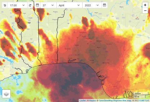
In the Sahel region of West Africa, the vast majority of flash floods are due to intense rain within long-lived mesoscale convective systems (large systems of thunderstorms), which have tripled in frequency over the last 35 years, an increase linked to global warming. Civil protection authorities and on-the-ground responders in the region need improved early warning of the likelihood of flood impact from national meteorological and hydrological services.
UKCEH led the NFLICS project which addressed this need by developing and testing automated approaches to predicting flood impacts. We worked in partnership to co-develop products and processes that met the demands of users and is helping them to safeguard their communities. The project drew on research findings from satellite analysis that identified land surface drivers of the extreme systems driving this rainfall.
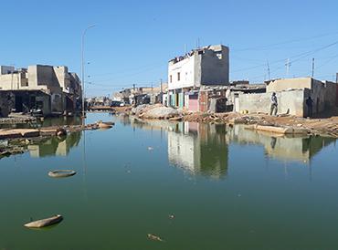
This collaborative project between scientists and policy-makers in West Africa and Europe helped to increase understanding of the regional climate and how it is changing, applying that knowledge to practical questions. It focused on extreme weather events that significantly impact on livelihoods (for example, flood-producing storms, crop-damaging dry spells), creating cutting-edge regional models and new understanding of what changes in climate will mean for flooding and water resources in the region. In Senegal, we worked with the national meteorological service, ANACIM, to see how useful very short-term forecasts are for local emergency responses.
A key output underpinning this work was the development of skilled researchers in West Africa, alongside increased uptake of climate information in decision-making.
Contact: Dr Chris Taylor | Read more
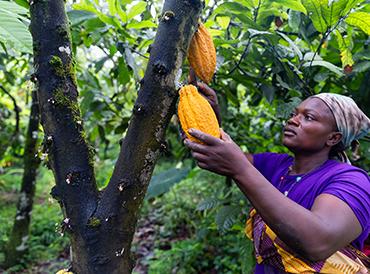
Cocoa production is crucial for West African economies. In Ghana, the world’s second-largest cocoa producer, smallholder-produced cocoa employs 800,000 farmers and accounts for over 90% of production. However, these farmers often lack critical resources and management options to improve their yields. .
The region is also experiencing changing climate, including longer dry seasons. Projected temperature increases and a long-term drying trend threaten future cocoa production, risking incomes and livelihoods.
The Co-Pod project created a new mobile app in collaboration with Ghanaian farming communities (Kakum, Central Region), the Nature Conservation Research Centre (NCRC), the University of Dundee, and Flumens Ltd. The app helps farmers capture and share information and gain new knowledge about adaptation and long-term resilience.

Over time, it will improve understanding of the risks and rewards of different interventions, ultimately leading to sustainable agroforestry practices that secure income and alleviate poverty.
Read more | Contact: Dr Lindsay Banin
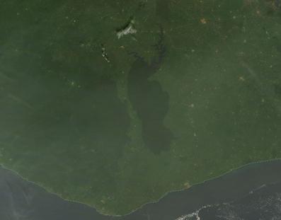
Much of West Africa was deforested throughout the 20th century, a process driven by agriculture, international trade in goods like cocoa, and the displacement of people by conflict. The rapid growth of cities, particularly along the coast, is also leading to deforestation in the region. This project revealed that deforestation in West Africa has made storms more frequent and thus increased the risk of disastrous flash flooding in the region’s coastal cities.
In collaborative work with the University of Leeds we used data from satellites and the latest weather and climate models to get to the heart of how vegetation affects rainfall. Focusing on West Africa, we examined cloud and vegetation observations from the last 30 years to detect where deforestation has changed rainfall, and how the rapid greening of the savannah each year affects the monsoon rains. We found from analysis of satellite observations that deforestation in southern West Africa has enhanced storm frequency over the last 30 years. The effect is particularly strong in coastal areas, where post-deforestation warming enhances land-sea breezes which are a key driver of storms.
Contact: Dr Chris Taylor