UKCEH offers a range of environmental software, much of which is available free of charge. Our other resources include the JULES model (opens in new window).
Flood Estimation Handbook: FEH Web Service
Industry standard methods for assessing flood risk in the UK
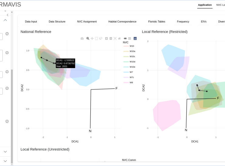
RMAVIS
An R Shiny application for the assignment of vegetation sample plot data to British National Vegetation Classification communities, the successor to MAVIS.
Global Water Availability Assessment Model (GWAVA)
GWAVA combines locally sourced data with global databases to give projections of future changes to water availability

Flood Estimation Handbook
Estimates flood risk in order to develop resilient infrastructure

SPMAPPER
An R package spatial planning tool to indicate the foraging value of marine areas to breeding seabirds.
Windermere Humic Aqueous Model (WHAM)
Simulates the resulting reactions of metals entering water and soil systems
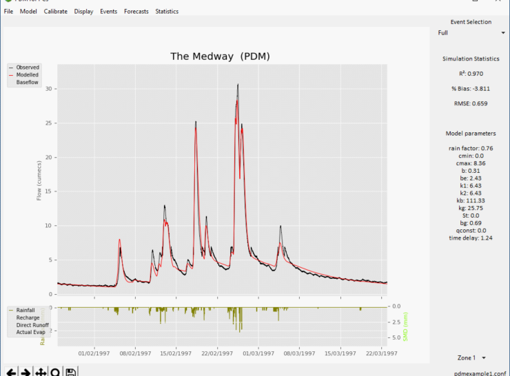
PDM (Probability Distributed Model)
A general conceptual rainfall-runoff model which transforms time-series of rainfall and evaporation to river flow at the catchment outlet
Modular Analysis of Vegetation Information System (MAVIS)
Allows vegetation to be compared across many classification systems

POSSMs
A simple model of soil metal chemistry
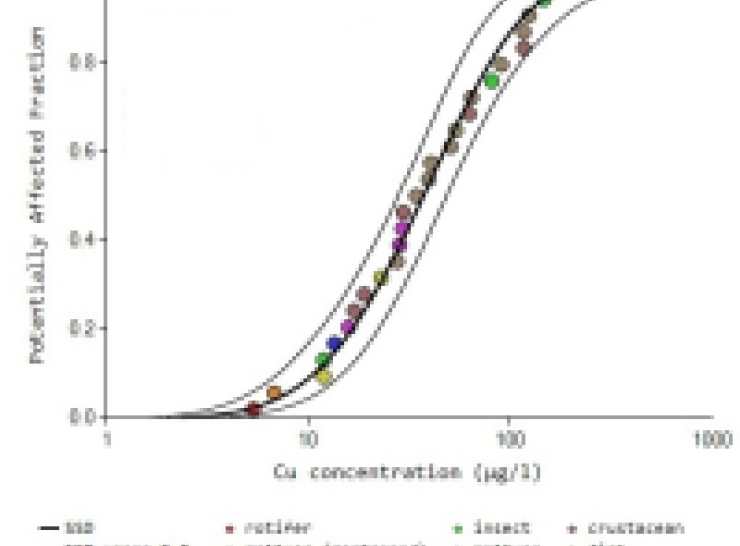
CuBioM
CuBioM, the Copper Bioavailability Modelling tool, was developed by UKCEH for the International Copper Association (ICA). It is designed to assist the Risk Assessment of copper in the freshwater environment under the EU regulatory framework.
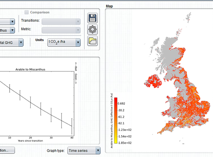
Ecosystem Land Use Model
The ELUM Model
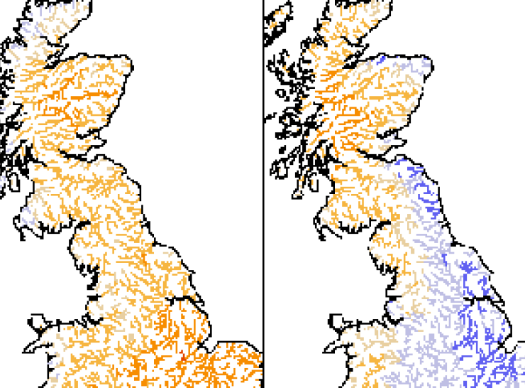
Future Flows maps and datasets
Provides a projection of river flows and groundwater levels throughout the country
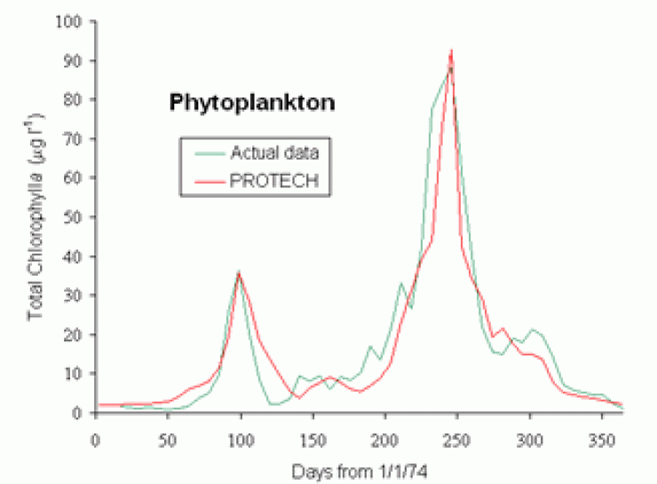
Lake ecosystem models: assessing phytoplankton
Assesses phytoplankton for lake management
Low Flows software
Provides estimates of river flows in the UK
WinTWINS version 2.3
Classifies species and samples - a Windows-based version of TWINSPAN
RIVPACS reference database
Estimates the ecological health of new running water sites

TABLEFIT and TABLCORN
Identifies and presents vegetation classification types

DECORANA and TWINSPAN
Classifies samples and multivariate species data

RAPID 3.0 software
A digital data entry system to capture and store River Habitat Survey data in the field

Coded List of Freshwater Algae 2014
Updated list of freshwater algae recordings in Britain and Ireland

Coded Macroinvertebrates List
Coded list of standard names and identifying codes for freshwater macroinvertebrates in the British Isles
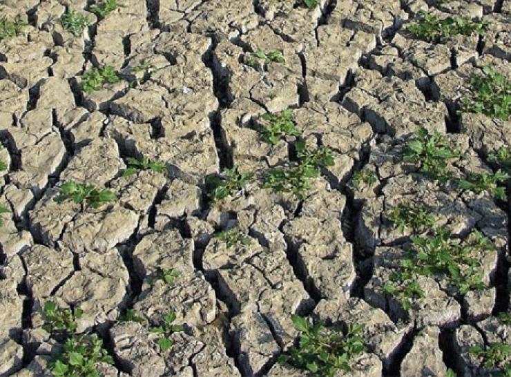
SALTMED
Predicts soil moisture and crop success in salinity-prone soils

River Flow Forecasting System (RFFS)
Produces forecasts of river level and flow in real-time and provides tools for off-line use

PC-QUASAR
Water quality and flow model for river networks
HYRAD
Weather radar providing flood warnings based on estimated rainfall
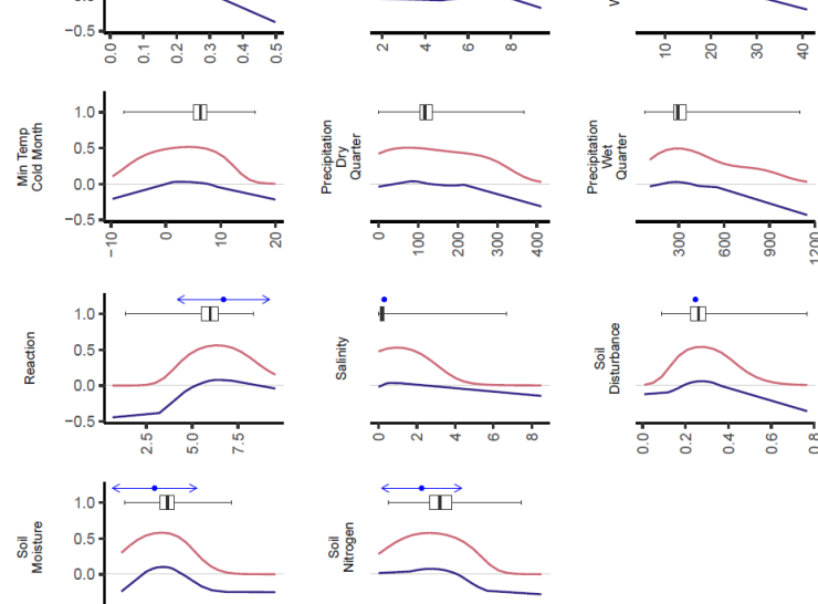
Ecological Niche Models for the Plants of Europe
elements is a R package containing ecological niche models for the most prevalent vascular plants, bryophytes, and terricolous lichens in the European Vegetation Archive (EVA) (Chytrý et al, 2016).