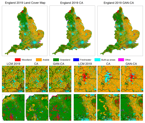
Spatial land use models are indispensable for providing scientific evidence that can inform sustainable land use planning. However, understanding and predicting agricultural land use change and the factors that drive such change is difficult due to the highly complex systems of flows that are subject to non-linearities, sensitivities, and uncertainties across spatial and temporal scales. This complexity is challenging to represent using traditional statistical modelling approaches. In this project, we explored and tested the ability of Artificial Intelligence (AI) techniques to complement traditional land use modelling approaches by learning complex spatial and temporal relationships between large geospatial land use datasets and datasets of important driving factors of land use change. This exploratory study aimed to demonstrate proof-of-concept for selected regions in the UK and provide greater understanding of the state and dynamics of agricultural land use systems and how they can be influenced by policy and management decisions.
The project ran from 1 October 2019 to 30 November 2020.


