Available translations: Not specified

Scientific challenge

Hydrological situation monitoring and early warning is crucial for water resources management, mitigation of hazards (eg flooding, landslides) and planning for agriculture and numerous economic sectors. Such monitoring is well established in the UK: the National Hydrological Monitoring Programme began in 1988 and the Environment Agency routinely produces monthly Water Situation Reports, while a Hydrological Outlook was launched in 2013.

Despite the richness of the data resource, the needs of many stakeholders are not met by existing programmes. Many stakeholders require information on components of the hydrological cycle that are not well monitored, particularly soil moisture and related vegetation status. Moreover, current programmes typically provide reports showing regional or national scale indicators, or for particular observation points, and they are generally provided at weekly or monthly updates. Increasingly, stakeholders require high spatial and temporal resolution information for local-scale planning, delivered close to real-time.

Hydrological situation monitoring and early warning is crucial for water resources management, mitigation of hazards and planning for agriculture and numerous economic sectors

There is significant potential to enhance hydrological situation monitoring through the use of Earth Observations (EO), a major under-utilised resource in current monitoring programmes. EO information has the benefit of being spatially continuous, timely (near real-time) and readily available. EO information also has the potential to improve hydrological forecasts provided through the Hydrological Outlook and other programmes, by offering scope for data assimilation using EO information, particularly soil moisture status. Finally, development of EO-based services for these purposes is very timely; capitalising on the Sentinel missions offers scope for step improvements in resolution and timeliness of EO information, and any advances made now could become embedded in long-term practice due to the guaranteed continuity (20 years) of these missions.

Project overview


Image
HydEOmex project logo

The Hydrological Earth Observation modelling exploration (HydEOmex) project was a small-scale (£25k) short-term pilot project (running January to May 2016) designed to demonstrate the potential of Earth Observations in hydrological applications for a range of stakeholders. The project was funded by NERC, following a funding ‘sandpit’ aimed at developing proof-of-concept ‘climate services’ applications.

The goal of the pilot study is to use EO products (in particular, soil moisture and vegetation condition) and integrate these with existing hydrometeorological monitoring programmes, to evaluate the potential benefits of more integrated monitoring and forecasting systems in future. The focus is on situation monitoring (nowcasting) and forecasting over the monthly-to-seasonal timescale, and not short-term (ie 1–5 day) flood forecasting. However, the potential benefits are clearly not just for drought, but also for early warning of persistent wet periods.

While the project was only a pilot study, the long-term vision is embed EO into decision making via improved monitoring, new indicators and enhanced modelling through data assimilation. The HydEOmex project is an ongoing partnership and plans to build on the demonstration outputs with a much more extensive monitoring system in future.


Image
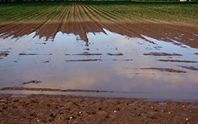
Flooded arable field
Image
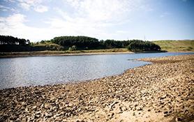
Hurstwood Reservoir credit: © United Utilities
Image
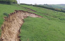
Landslide

The project appraised indicators for three key sectors: agriculture, water supply and geohazards

Method

HydEOmex had three main tasks:

Task 1 Data: collating existing hydrometeorological datasets (rainfall, river flows, groundwater), in-situ soil moisture measurement networks and multi-source EO products (e.g. ASCAT soil moisture, MODIS EVI). 

Task 2 Analysis: Two important scientific objectives were to (1) compare different sources of soil moisture measurement (EO, ground-based sensors and modelling outputs) to evaluate their consistency, and to (2) evaluate whether EO soil moisture assimilation improves existing hydro(geo)logical model predictions.

Task 3 Impact: the objective of this task was to appraise the potential for developing indicators based on existing monitoring datasets and new EO products, suitable for identifying impacts in three key stakeholder sectors (agriculture, water supply and geohazard management).  This task also focused on integrating key datasets into a demonstration portal to allow users to access data and indicators.

The key outputs were:

  1. New datasets of EO and updated hydrometeorological datasets, all on the same format and grid system
  2. Validation of existing hydrological / land surface modelling tools using EO data
  3. Assessment of potential of soil moisture data assimilation (both in-situ and EO) for improving hydro(geo)logical model predictions
  4. Appraisal of new indicators for three key sectors (agriculture, water supply, geohazards)
  5. Demonstration of a pilot web portal to allow visualisation and mapping of datasets.

A series of reports describing the outputs are in progress and will be added below as they become available:

  1. Index-based approaches for drought monitoring (Airbus DS) [PDF]
  2. The use of HydEOmex data to validate a land surface model over the UK [PDF]
  3. Constraining recharge and groundwater models with HydEOmex soil moisture observations [PDF]

Click here to view the HydEOmex demonstration portal

Principal Investigator

  • 2013 onwards: Group Leader, Hydrological Status and Reporting Group, UKCEH

  • 2009 - 2014: Head, National River Flow Archive (NRFA), CEH.

  • 2007 - 2009: Leader, NRFA Data Analysis and Exploitation function, CEH 

  • 2001 - 2007: Hydrological Analyst in the National River Flow Archive (NRFA) at CEH, developing methods for data acquisition and quality control, and working on trend detection